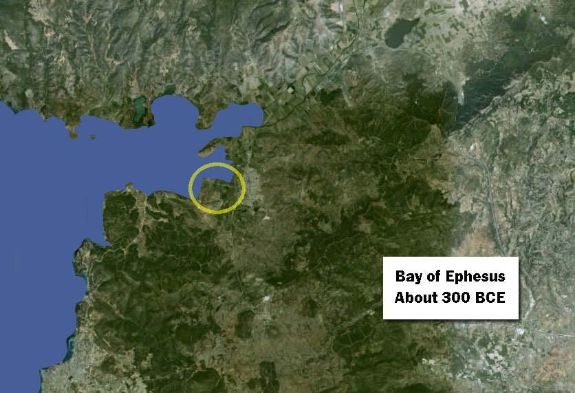
300 B.C.E.: the Bay of Ephesus no farther inland than Artemision
By about 300 century B.C.E., all of the Bay of Ephesus upstream from the city has disappeared, filled in by the silt of the Cayster River. At this time, the city of Ephesus and the Artemision are at the southern corner of the Bay. Lysimachus makes a drastic change: he orders that the city be moved from its place around the Artemision to the west side of Mount Pion. This solves the harbor problem for his time, but not permanently.
Want to dive deeper?
John C. Kraft, Helmut Brückner, Ilhan Kayan, and Helmut Engelmann. “The Geographies of Ancient Ephesus and the Artemision in Anatolia,” Geoarchaeology: An International Journal, Vol. 22, No. 1 (1997): 121–149. Cited January 17, 2017.
A team of scientists made an extensive series of bore-holes around the Ephesus area and analyzed the resulting core samples. They determined dates when the tested area was under water and compiled maps showing the shoreline at given dates in ancient times. My maps are based on this research, primarily the maps on pp. 127, 130, 142, and 143.
- Satellite image of central district
- Plan of Ancient Ephesus and the Temple of Artemis
- The shifting shoreline of Ephesus
