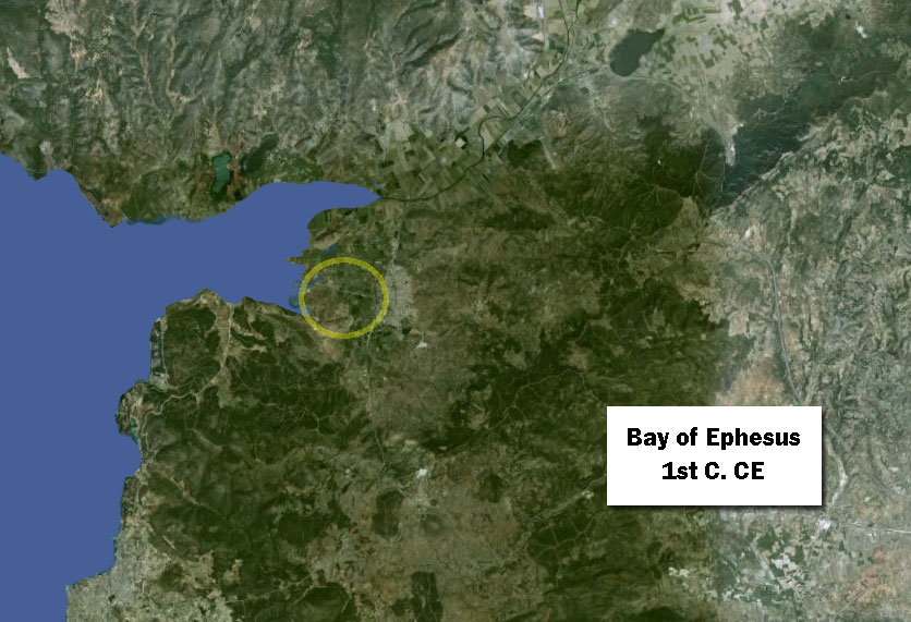
Only a temporary solution: the Bay of Ephesus in the First Century C.E.
First-century Ephesus has a large harbor, but it is already a considerable distance west of the city. Even though it is protected by a huge dike (mole), it is constantly silting up and has to be dredged and cleared of sand bars.
Want to dive deeper?
John C. Kraft, Helmut Brückner, Ilhan Kayan, and Helmut Engelmann. “The Geographies of Ancient Ephesus and the Artemision in Anatolia,” Geoarchaeology: An International Journal, Vol. 22, No. 1 (1997): 121–149. Cited January 17, 2017.
A team of scientists made an extensive series of bore-holes around the Ephesus area and analyzed the resulting core samples. They determined dates when the tested area was under water and compiled maps showing the shoreline at given dates in ancient times. My maps are based on this research, primarily the maps on pp. 127, 130, 142, and 143, as well as Figure 1 from the following article.
Hugo Delile, Janne Blichert-Toft, Jean-Philippe Goiran, Friederike Stock, Florent Arnaud-Godet, Jean-Paul Bravard, Helmut Brückner, and Francis Albarède. “Demise of a harbor: A geochemical chronicle from Ephesus,” Journal of Archaeological Science, 53 (2015): 202-213. Figure 1.